Hit the Trails at These 10 Great Day Hikes Near Saratoga Springs, NY
Are you looking to get out and go hiking on a nice sunny day? From Hadley Mountain to Crane Mountain and Thacher State Park, there are a wide range of day hikes that are well worth the drive from Saratoga. Get details on 10 of the best day hikes in the region and plan your next outdoor adventure today!
Hadley Mountain
- Trail Rating: Easy to Moderate
- Distance (One-Way): Approx. 1.8 miles
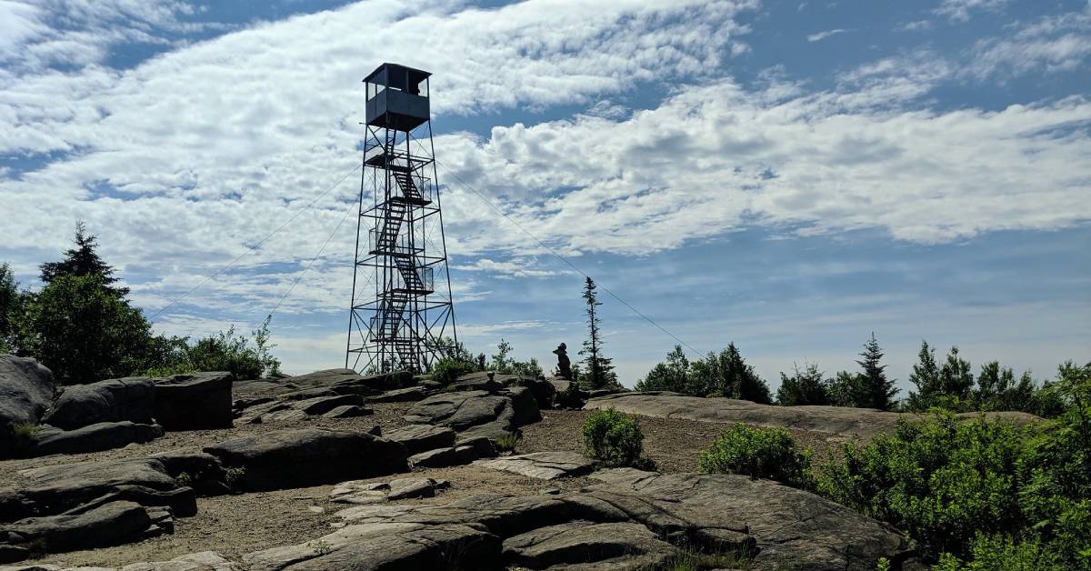
A fun fire tower hike in the southern Adirondacks, Hadley Mountain is an excellent choice for families at 3.6 miles round trip. Although the trail begins as a moderate climb, it's never too steep, and you'll pass by some small boulders along the way where you can take a short break if needed.
The summit is large, open, and perfect if you brought a picnic lunch. You can check out views to the south and east, or climb up the restored fire tower for an even better look at the surroundings. During the summer, hikers may be greeted by a young steward who helps maintain and repair the trail and structures.
Location: The trailhead is on Tower Road in the Town of Hadley, and there is a parking area for over 12 cars.
Spruce Mountain
- Trail Rating: Easy to Moderate
- Distance (One-Way): Approx. 1.3 miles
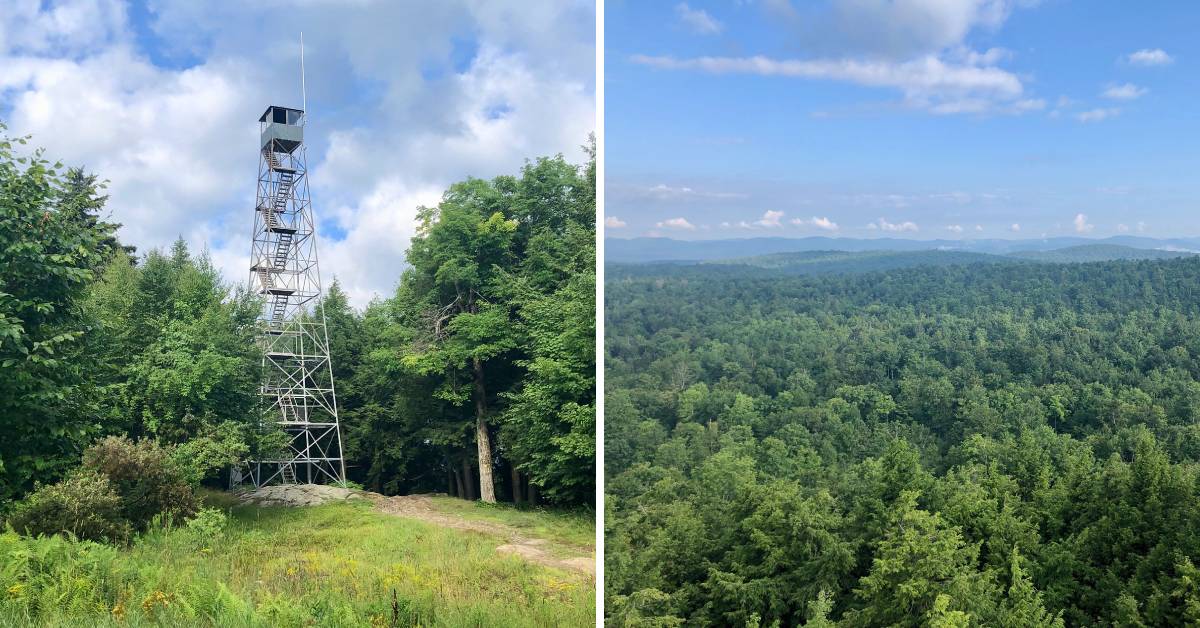
Enjoy a hike to a 73-foot tall fire tower at the summit of Spruce Mountain in the Town of Corinth. It's a steady climb to the top, and the trail is well-marked and doable with kids or beginner hikers. The summit is rocky and grassy, as pictured above, but take note that you have to climb up the fire tower to see the views.
Location: The trailhead is located at the end of Spruce Mountain Road in Corinth.
Thacher State Park
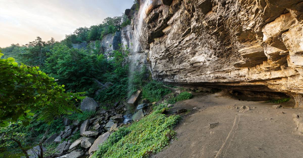 Photo Credit: Greg Hanselman
- Trail Rating: Easy to Moderate
- Distance: Over 25 miles of trails
John Boyd Thacher State Park is a large New York State Park in the Capital Region with a campground, miles of limestone cliffs and woodlands, and trails for hiking, mountain biking, cross-country skiing, and more recreational activities. There are trails in both the north and south sections of the park, and they vary in length from .33-mile to 4.16 miles.
The park is open year round from dawn to dusk, and there is a small vehicle entrance fee from May 1 - October 31. Go for an invigorating hike along the trails, and then end your trip with a meal at the picnic areas.
Location: The state park is located at 830 Thacher Park Road, Voorheesville, NY.
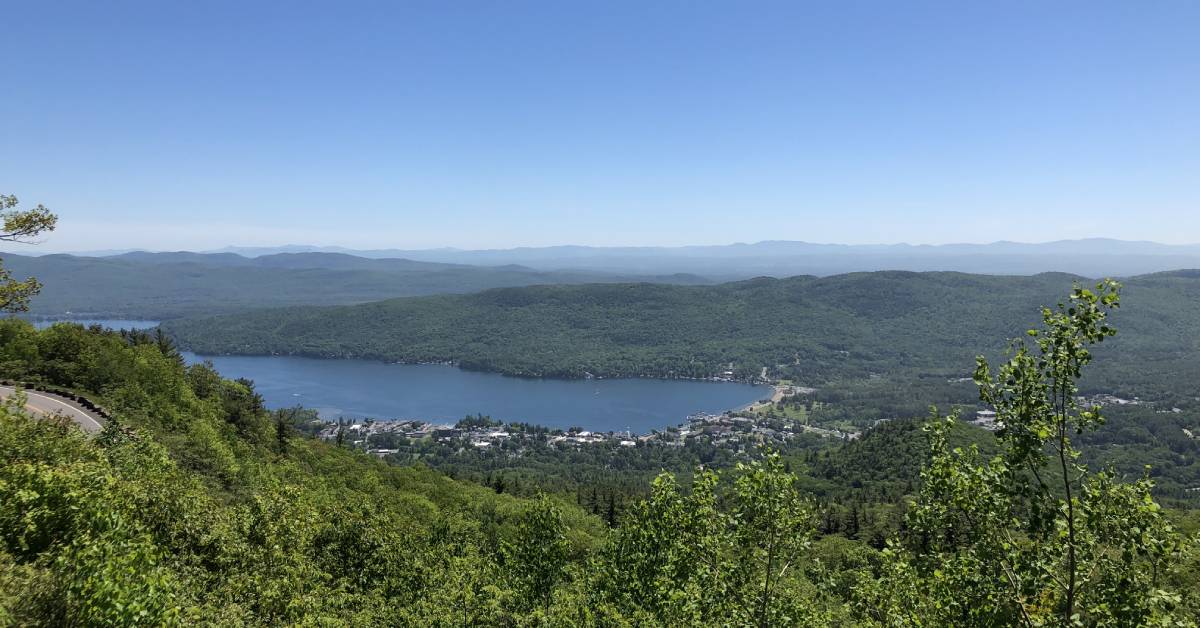
Prospect Mountain
- Trail Rating: Moderate to Difficult
- Distance (One-Way): 1.5 miles
Some of the best views of Lake George and the village can be seen from the 2,030-foot summit of Prospect Mountain. The hiking trail to the summit begins in Lake George Village, and it is well marked with steep terrain. The spacious summit features a day use area and multiple viewpoints. You'll also see the remnants of an old cable railway at the far end of the summit.
In addition, the Prospect Mountain Veterans Memorial Highway is open seasonally if you'd like to drive up to the summit instead. The price to access the highway varies by vehicle, and the 5.5-mile road features three scenic outlooks on the way to the top.
Location: The trail begins on Smith Street in Lake George Village. There is a small parking area, and then you'll walk over an enclosed, elevated bridge before beginning the ascent.
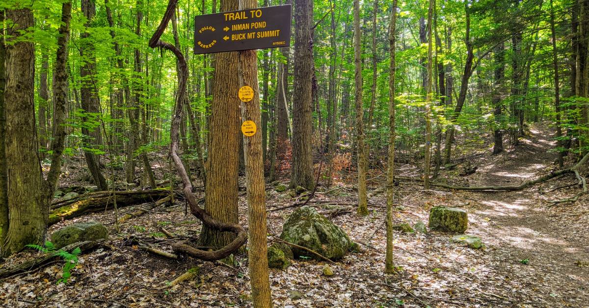
Buck Mountain
- Trail Rating: Moderate
- Distance (One-Way): 3.3 miles from Pilot Knob Road; 2.5 miles from Shelving Rock Road
Buck Mountain is the first of three hikes we're featuring that are located on the east side of Lake George. This is a moderate hike that brings hikers up to a 2,330-foot summit with great views of the lake and Adirondack mountains. There are two trails you can take, but the most popular is the one that begins on Pilot Knob Road. This trailhead and parking area is for both Buck Mountain and the short Stewarts Ledge trail, so make sure you follow the signs.
The other trail to the summit of Buck Mountain begins on Shelving Rock Road, and it is approximately 2.5 miles one-way. If the parking area is full, consider checking out Sleeping Beauty Mountain or Shelving Rock, which we've highlighted below.
Location: One trailhead is located on Pilot Knob Road in Kattskill Bay, and the other trailhead is located on Shelving Rock Road in Fort Ann.
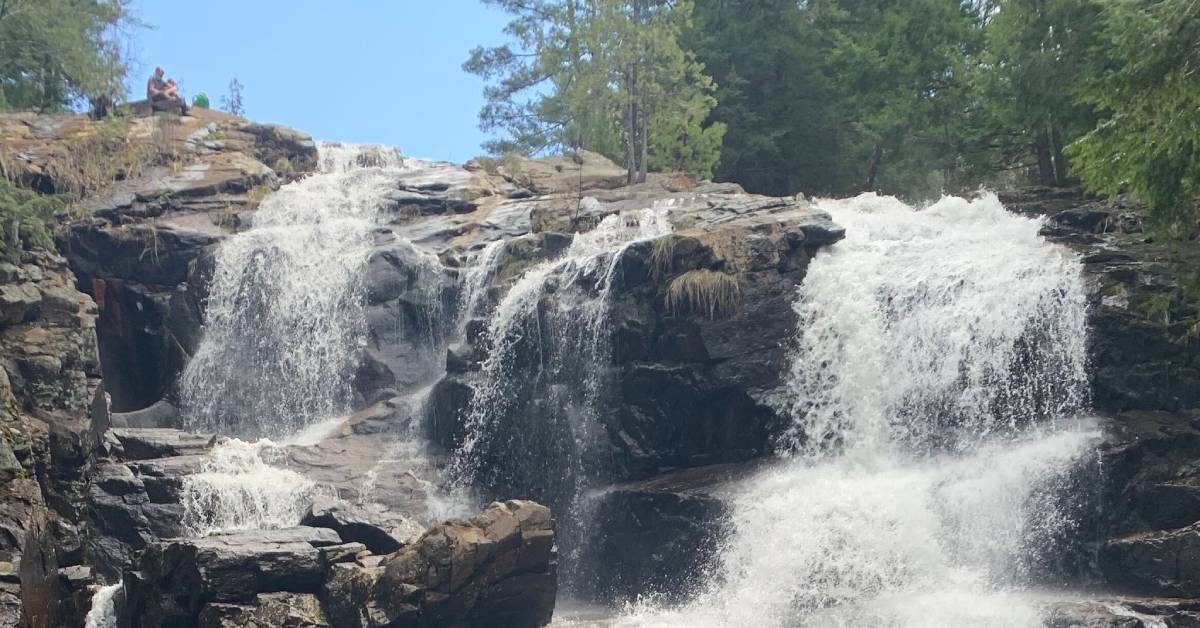
Shelving Rock Falls & Summit
- Trail Rating: Easy to Moderate
- Distance (One-Way): 1.7 miles (to the summit); .4-mile (to the waterfall)
Shelving Rock in Fort Ann is a popular hike on the eastern shore of Lake George, and there are two routes you can take. The first is the 1.7-mile Shelving Rock Summit Hike, a relatively easy hike that follows an old carriage road. Once you reach the summit, there will be a short path that leads to awesome views of Lake George and the surrounding mountains.
Interested in a waterfall hike instead? Starting from the same trailhead, you can hike for approximately .4-mile on the Shelving Rock Falls trail to the 50-foot waterfall. This route is scenic and family-friendly, but be cautious around the rocks by the waterfall, as they may be wet and slippery.
Location: The trailhead is located near the end of Shelving Rock Road in Fort Ann.
Sleeping Beauty Mountain
- Trail Rating: Easy to Moderate
- Distance (One-Way): 1.8 miles from Dacy Clearing trailhead/parking area; 3.4 miles from Hogtown trailhead/parking area
Amazing views await when you reach the summit of Sleeping Beauty Mountain on the east side of Lake George. This hike is suitable for families with older children as it features easy to moderate terrain to the summit. However, be prepared for the parking situation.
During the warmer months and periods of dry weather, the road from the Hogtown trailhead/parking area to the Dacy Clearing trailhead/parking area is open for vehicles. This is a single-lane, dirt road with bumps and dips, and it will bring you to the Sleeping Beauty Mountain trail at Dacy Clearing.
However, if this road is closed, you'll have to park at Hogtown and hike the additional 1.6 miles to Dacy Clearing.
Location: The Hogtown trailhead/parking area is located just off Shelving Rock Road in Fort Ann. Dacy Clearing is located at the end of the road connected to the Hogtown parking area.
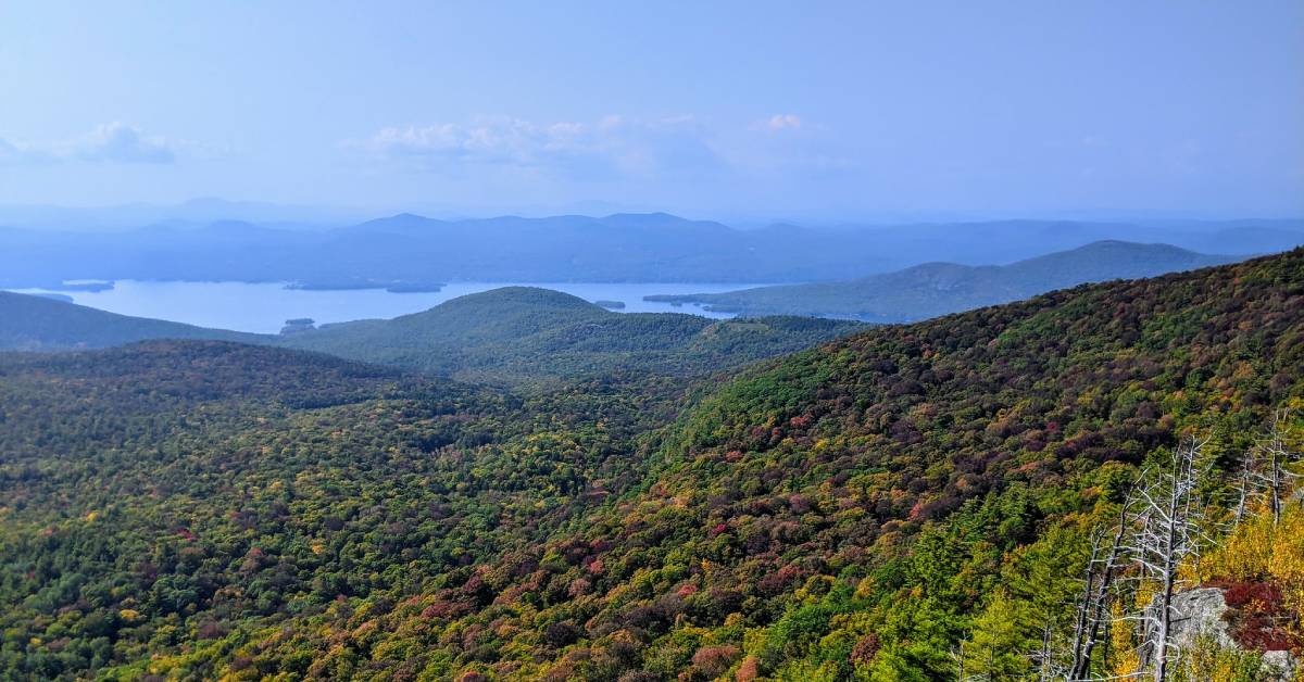
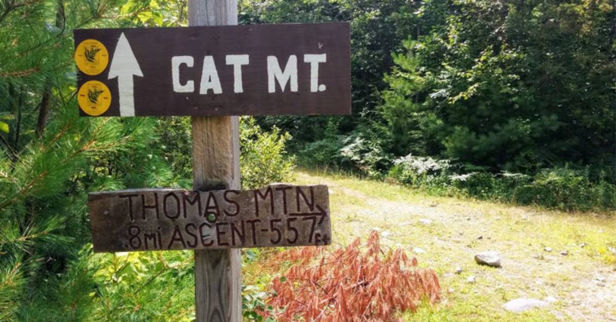
Cat Mountain
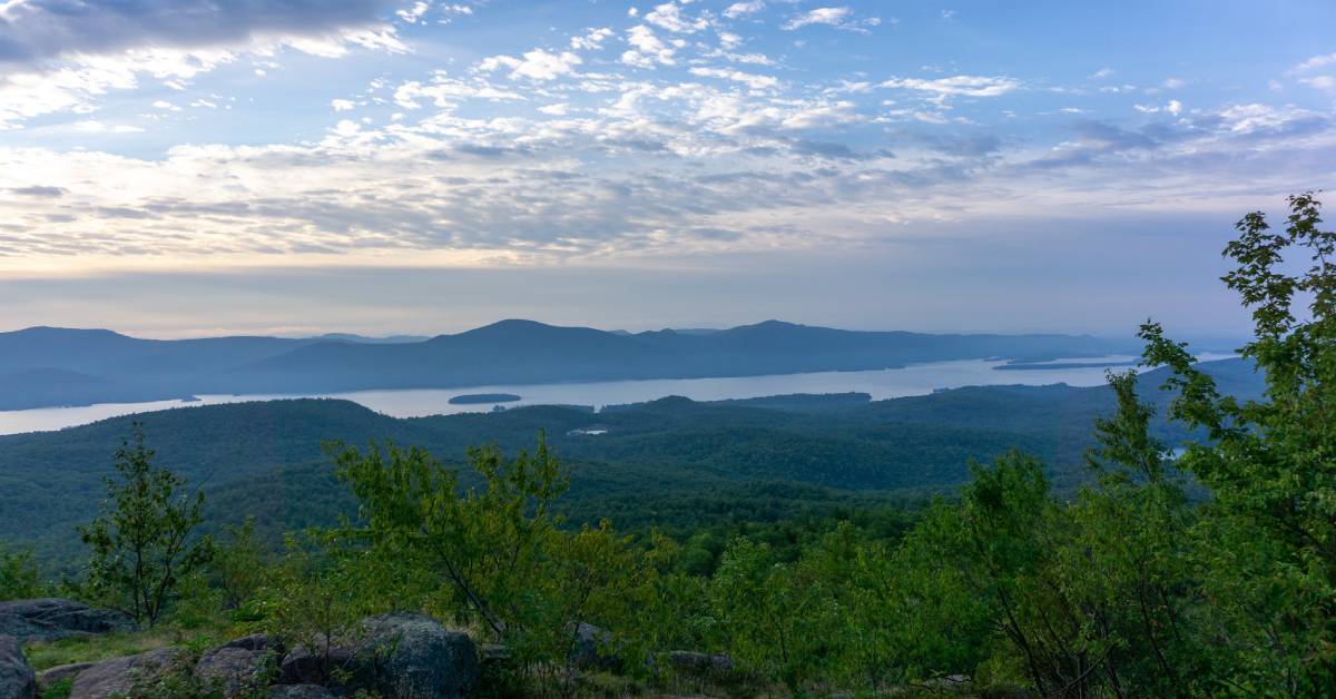 Photo Credit: Kevin Hanselman
- Trail Rating: Moderate to Difficult
- Distance (One-Way): Approx. 3 miles
The trails at the Cat and Thomas Mountains Preserve in Bolton Landing are maintained by the Lake George Land Conservancy, and you can hike to the summit of both Cat Mountain and its neighbor Thomas Mountain (learn more in the next section). As you can see from the photo above, Cat Mountain features a fantastic 270 degree view of Lake George and the Adirondacks.
There are a few ways you can reach the summit of Cat Mountain:
- From the parking lot on Edgecomb Pond Road in Bolton, follow the trail 1.9 miles to the summit.
- From the parking lot on Valley Woods Road, follow the trail for Cat and Thomas Mountains, and then at the intersection, follow the blue trail to reach the Cat Mountain summit. This trail is 3 miles one way.
- Or, from the Thomas Mountain summit, you can hike 2 miles on the Richard Hayes Phillips Trail to the Cat Mountain summit. Footing is difficult on this trail and results in a more challenging trek for hikers.
See the Lake George Land Conservancy's trail map »
Location: The trailhead is on Valley Woods Road in Bolton Landing, and there is a sign for both Cat and Thomas Mountains.
Thomas Mountain
- Trail Rating: Moderate
- Distance (One-Way): Approx. 1.4 miles
The Thomas Mountain Trail in Bolton Landing is commonly paired with its neighbor, Cat Mountain, and the two trails are connected. Alone, Thomas Mountain is a short, moderate hike that's 1.4 miles from the trailhead to the summit.
The first section of the trail is .7-mile long that starts with a wide dirt road, and then it becomes rocky. When you reach the intersection for Cat Mountain and Thomas Mountain, you'll want to follow the sign pointing toward Thomas Mountain. From there, the trail ascends to the large summit.
See the Lake George Land Conservancy's trail map »
Location: The trailhead is on Valley Woods Road in Bolton Landing, and there is a sign for both Cat and Thomas Mountains.
Crane Mountain
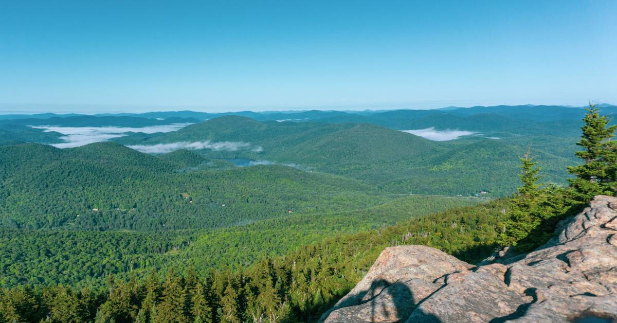 Photo Credit: Kevin Hanselman
- Trail Rating: Difficult
- Distance (One-Way): Approx. 1.4 miles for the shorter trail, or 2.7 miles for the longer trail
If you're looking for a challenging hike with rewarding views at the end, then you should check out Crane Mountain in Johnsburg. This southern Adirondack mountain features two main trails to the top, and both have steep sections that require rock scrambling.
The shortest trail is a direct route to the summit, includes two ladders to climb, and is 1.4 miles long. The other trail is longer at 2.7 miles, but it will bring you around a beautiful pond. You can combine both trails for a round-trip loop.
Once you reach the summit, you'll enjoy a breathtaking view of the surrounding mountains and forests.
Location: The trailhead is located at the end of Ski Hi Road in Johnsburg.
Looking to step up your hiking game? Check out this Adirondack Hiking Guide »