Bike Your Way Through Saratoga County, NY: Discover the Region's Best Bike Routes
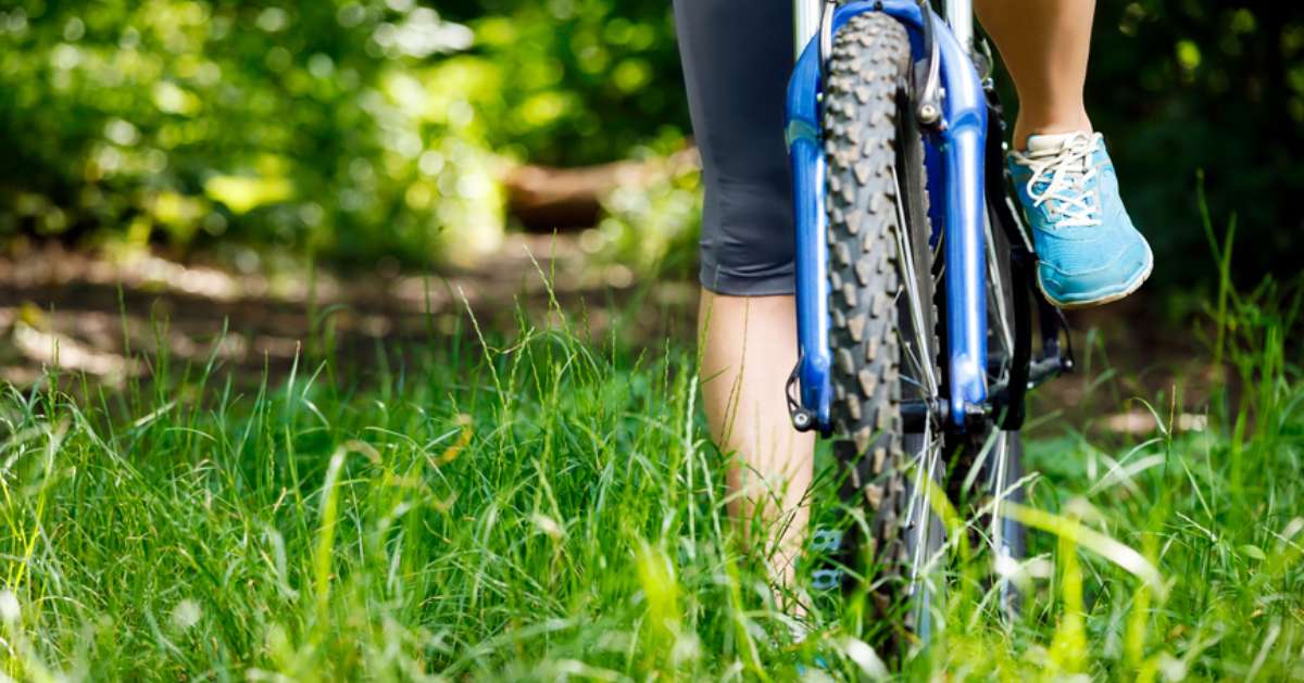
Whether you're riding on quiet country roads, over rolling terrain, across beautiful bridges, or through a lush forest, biking offers a wonderful feeling of freedom. Not only is it an excellent exercise, but it's one of the greatest ways you can experience a region. For a memorable ride to historic sites, local landmarks, parks, and natural attractions, plan a trip to one of these bike routes in Saratoga County, NY.
JUMP TO: Saratoga Springs Bike Route | Schuylerville Bike Route | Clifton Park Bike Route | South Glens Falls Bike Route
Saratoga Springs Bike Route (Approx. 7.8 Miles Round Trip)
Saratoga Springs is a bicycle-friendly community with a variety of trails and streets to follow. To showcase some of the best parts of the city, this bike route will bring you from downtown Saratoga to Congress Park, Saratoga Spa State Park, and other local hotspots.
Starting Out
Although downtown Saratoga has several parking options, we suggest leaving your car at the Putnam Street Parking Lot or the Putnam Street Parking Deck located across the street. From both parking areas, you can ride across Spring Street and enter the first stop on this route, Congress Park.
Visit Two Beautiful Parks
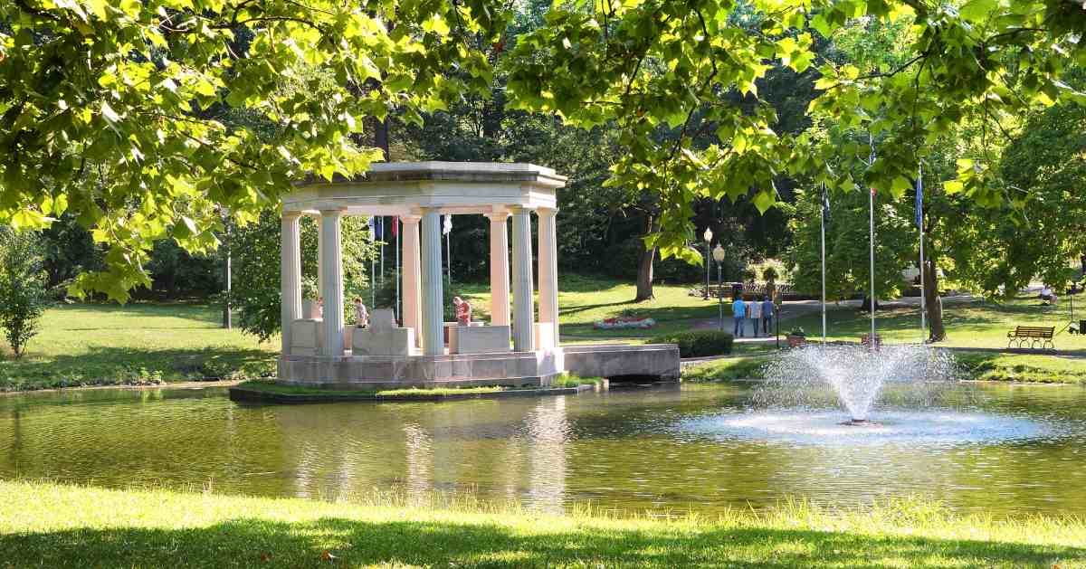
Nestled at the southern edge of downtown Saratoga, Congress Park is a popular park for strolling, biking, picnicking, and relaxing. The park is home to ornate fountains, mineral springs, a War Memorial, an 1870s casino building, and more attractions.
Enjoy a short ride through the park, and then make your way west to Railroad Run, a .5-mile trail that will bring you into the northern entrance of Saratoga Spa State Park. This state park features miles of recreational and nature trails, and you can easily spend some time exploring them all. After you've checked out the historic buildings and mineral springs, it's time to continue on the bike route.
Get a Taste of the Excitement at Saratoga Race Course
The next section of the route will lead you out of Saratoga Spa State Park and northeast toward Saratoga Race Course. On racing days during a typical summer, you'll see the racetrack full of people and a lively atmosphere as you ride down Union Avenue.
Walk Through the Serene Yaddo Gardens
Before you reach the Adirondack Northway, take a right turn from Union Avenue onto Henning Road, which will take you to Yaddo Gardens. Yaddo is an artists' retreat with vibrant gardens that are open seasonally. Park your bike and experience a self-guided tour of the Rose Garden, woodland rock garden, and pergola.
The Return Trip
To get back to the starting point, you'll ride west on Union Avenue back to an intersection with Nelson Avenue. Follow Nelson Avenue to Spring Street, and then ride up the road to the Putnam Street Parking Lot.
Saratoga Springs Bike Route Map & Directions:
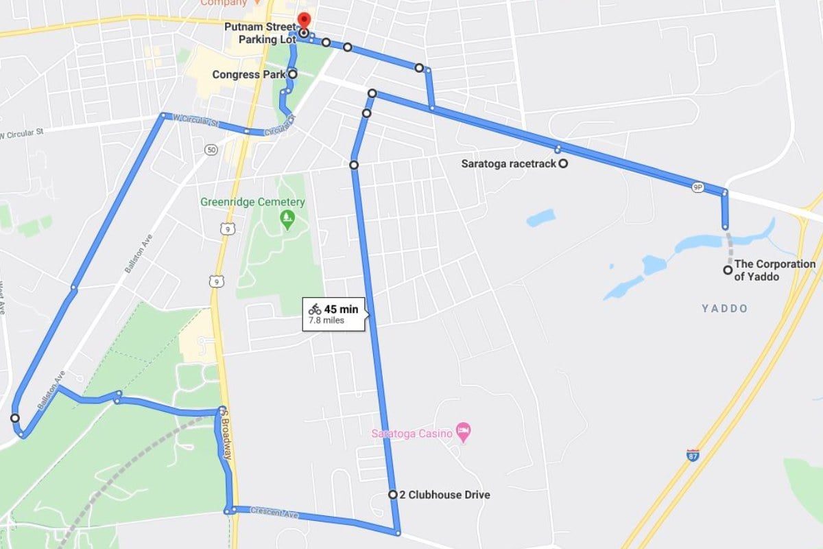
- From the Putnam Street Parking Lot, ride down Putnam Street and cross Spring Street to enter Congress Park from the north. Ride through the park, and then exit onto Circular Street and go right.
- Stay on Circular Street, cross Broadway, and then continue on the road as it becomes W. Circular Street. At the intersection with Beekman Street, you can turn left onto the Railroad Run trail. Follow the trail to the end, and then cross a crosswalk into Saratoga Spa State Park.
- You can travel farther into the park and explore the trails and historic buildings. Or, follow the path east and then south to a three-way intersection with the park entrance, S. Broadway, and Crescent Avenue. Cross S. Broadway and ride east on Crescent Avenue.
- Stay on Crescent Avenue, and then turn left onto Jefferson Street. This is a long stretch, but eventually Jefferson Street will end, and you will go straight onto Clark Street. Clark Street will end at an intersection with Union Avenue. Turn right.
- Ride down Union Avenue past Saratoga Race Course, and then turn right onto Henning Road. You will now be at Yaddo Gardens.
- Done exploring? Exit Yaddo from Henning Road, and then turn left back onto Union Avenue. Stay on Union Avenue until you reach the intersection with Nelson Avenue. Turn right, and follow Nelson Avenue to an intersection with Spring Street. Turn left onto Spring Street, and this will bring you back to the Putnam Street Parking Lot.
Schuylerville Bike Route (Approx. 5.8 Miles Round Trip)
Schuylerville is a village that's overflowing with history, and you can learn all about it while biking to various historic sites and landmarks. We've designed a bike loop through the community that begins and ends at Hudson Crossing Park. This route will take you to Fort Hardy Park, the Schuyler House, the Saratoga Monument, and beyond.
Note: Although this route is only 5.8 miles round trip, it's recommended for experienced riders with mountain or gravel bikes, as you'll encounter some uphill and gravel sections along the way.
Starting Out
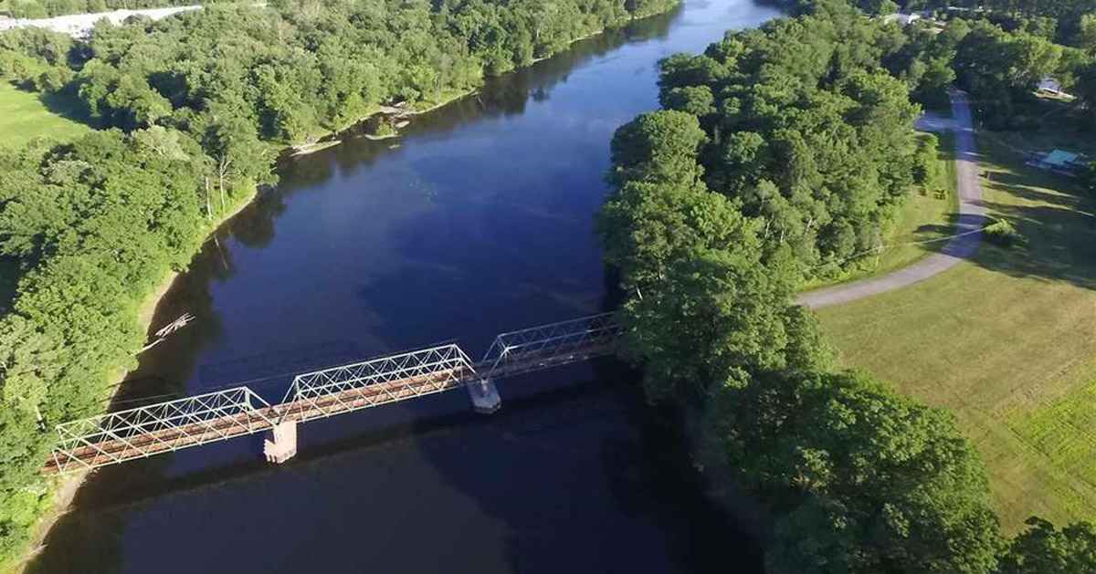
To begin, take a drive to Hudson Crossing Park, a year-round recreational and educational park that's open to the public. Visitors may park their car and enjoy the picnic facilities, fishing and birding sites, views of the Hudson River and Champlain Canal, and two miles of nature trails.
Take a Tour of Popular Historical Parks
Hudson Crossing Park's trails are open to hikers and bicyclists, so if you'd prefer, you can take a short ride through the park before following the rest of our route. You'll find informative signage displaying facts about nature and the local area.
When you're ready to officially start this bike route, head to the southern entrance of Hudson Crossing Park and ride down the Old Champlain Canal Tow Path. This path will bring you along the Hudson River to Fort Hardy Park. Back in 1755, Fort Hardy was built at this site and served as a supply post for expeditions against Crown Point. Today, it's a public recreational park with a playground, picnic area, and more.
Explore Schuylerville's Connection to the American Revolution
From Fort Hardy Park, continue south toward the local post office and get back on the Old Champlain Canal Tow Path. This stretch of the path will bring you over Fish Creek to the General Philip Schuyler House, which is open seasonally for visitors and tours.
Next, leave the Schuyler House and follow the path onto U.S. 4, cross the bridge, and then ride west toward two historic sites - Victory Woods and the Saratoga Monument. Victory Woods is a .5-mile self-guided walking trail marking the final encampment for the British Army under General Burgoyne before their surrender to American forces. Located just around the corner from Victory Woods, the Saratoga Monument is a 155-foot tall stone obelisk commemorating Burgoyne's surrender.
Note: From U.S. 4 to Victory Woods, you'll be biking uphill along Burgoyne Street for about .5-mile. We recommend having experience biking up and down hills before attempting this route.
The Return Trip
Your return to Hudson Crossing Park will take you along picturesque farmland and country roads. One of the roads, Starks Knob Road, features a short trail leading up to Stark's Knob, a basaltic pillow lava formation that's around 440-460 million years old. Get a close look at this unique natural attraction, and then ride south on U.S. 4 back to Hudson Crossing Park.
Schuylerville Bike Route Map & Directions:
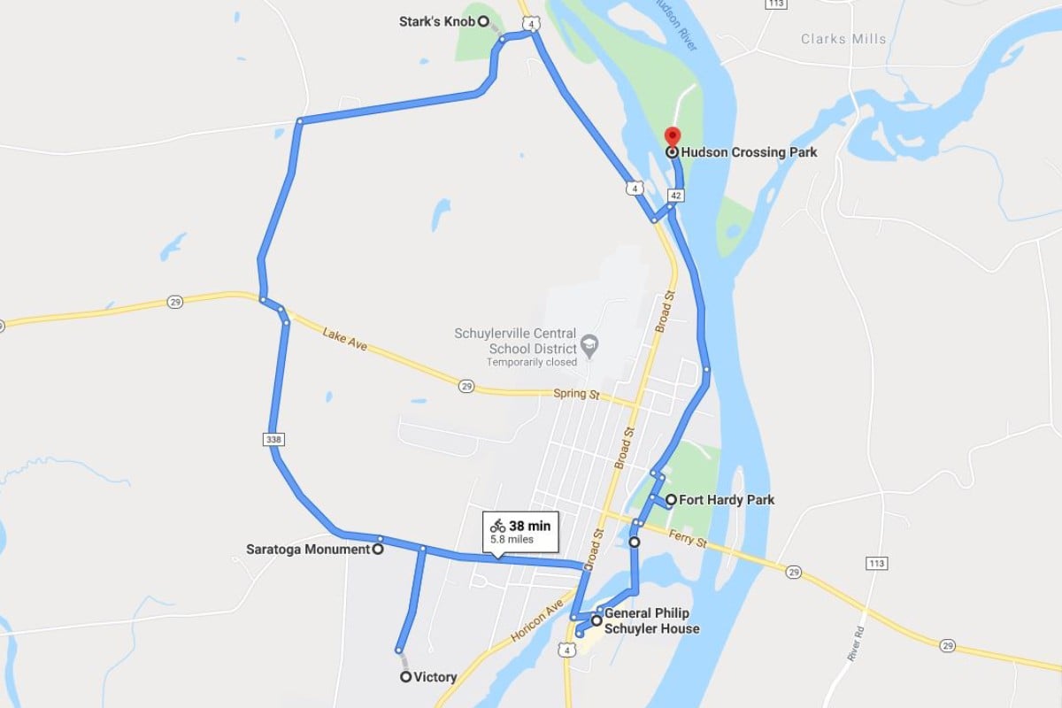
- Park your car at Hudson Crossing Park and bike to the southern entrance.
- Begin riding down the Old Champlain Canal Tow Path. This trail will bring you deeper into Schuylerville to Saratoga Street. At the intersection, turn left, and then follow the road to Fort Hardy Park.
- After a brief break, turn onto Reds Road, and go south toward Ferry Street. You should see the post office across the street. Head toward the post office, and there will be a trailhead to another stretch of the Tow Path.
- This trail will end at the General Philip Schuyler House. From here, stay on the trail until you exit on U.S. 4. Turn right, ride north across the bridge, and then turn left onto Burgoyne Street.
- For about .5-mile, you'll be biking uphill along Burgoyne Street until you reach Monument Drive on your left. Take the turn, and then follow the road to the entrance of Victory Woods.
- Starting from Victory Woods, bike back to the intersection with Burgoyne Street. Go left, and you'll soon pass the Saratoga Monument. A parking area is located nearby down Cemetery Road.
- From the intersection with Burgoyne Street and Cemetery Road, get back on Burgoyne Street and follow it north as it becomes County Route 338.
- You'll reach an intersection with NY-29. Watch for traffic (cars drive in both directions), and then turn left onto NY-29 and then turn right onto Grange Hall Road. Stay on Grange Hall Road until you arrive at a four-way intersection. Turn right onto Starks Knob Road.
- Starks Knob Road is unpaved and will bring you downhill, so this is why a mountain or gravel bike is recommended. The road ends at an intersection with U.S. 4. The trailhead to Stark's Knob is right before the intersection.
- When you're ready to return to Hudson Crossing Park, turn right onto U.S. 4, and ride south until you reach the park entrance on your left. Stay to the side of the road and be cautious of traffic on your way back to the park.
Clifton Park Bike Route (Approx. 9.9 Miles Round Trip)
One of Saratoga County's most scenic bike routes is located at the Vischer Ferry Nature & Historic Preserve in Clifton Park. Vischer Ferry comprises 700+ acres of wetlands, floodplain, and natural habitats, an abundance of nature trails, and two Erie Canal towpath trails. This route will bring you down an old towpath trail that has been transformed into a multi-use recreational trail.
Starting Out
Although there are several entrances to the towpath trail, this bike route begins at the Lock 7 Dam Overlook, otherwise known as the western gateway to the Vischer Ferry Nature & Historic Preserve. This area offers a panoramic view of the historic Lock 7 Dam on the Mohawk River. Park your car in the gravel lot and prepare to head down the nearby bikeway toward Vischer Ferry.
Follow an Old Towpath Trail Through Vischer Ferry
This designated bikeway follows the Mohawk River shoreline, and you can enjoy beautiful views of the natural surroundings during the ride. Eventually, you'll reach a three-way intersection with Ferry Drive and the Towpath Trail. If you'd like a short detour, head north onto Ferry Drive to Riverview Road and the Vischer Ferry General Store. This local hotspot offers breakfast, lunch, snacks, and other goods.
Head back to the three-way intersection with the Towpath Trail, and begin biking east along the trail. The Towpath Trail includes a stop at Lock 19 of the Erie Canal and opportunities to slow down and appreciate this peaceful preserve.
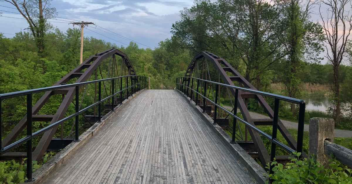
See the Sights From an 1862 Whipple Truss Bridge
At the end of the Towpath Trail, you'll be at an intersection with Van Vranken Road. You can turn right to ride deeper into the preserve, or turn left and cross the 1862 Whipple Truss Bridge. We suggest you turn onto the bridge, get a good look at the wetlands below, and then ride one mile down Riverview Road to Clute's Dry Dock, a historical landmark and wildlife viewing area.
Fun fact: The ride down Riverview Road is part of the Mohawk Towpath Byway, a series of local, county, state, and federal highways that follow the Erie Canal between Schenectady and Waterford. Today, the Byway is a popular route for bicyclists.
The Return Trip
To return to the Lock 7 Dam Overlook, you will follow the same route back starting at Clute's Dry Dock. If you didn't stop at the Vischer Ferry General Store earlier, now would be a great time to get a bite to eat near the end of your ride. When you've finished with your meal, follow the bikeway north to the original parking area.
Clifton Park Bike Route Map & Directions:
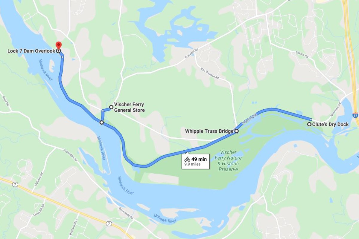
- Park your car at the Lock 7 Dam Overlook, and then ride down the bikeway.
- The bikeway will intersect with the Towpath Trail and Ferry Drive. You can follow Ferry Drive and Riverview Road to the Vischer Ferry General Store, or start riding on the Towpath Trail.
- The Towpath Trail will bring you through the preserve, past Lock 19, and then end at an intersection with Van Vranken Road. Turn right to explore more of the preserve, or turn left and cross the Whipple Truss Bridge to reach Riverview Road.
- Turn right onto Riverview Road, and then stay on the road for about one mile until you get to Clute's Dry Dock on the right.
- After you're done checking out the area, you can follow the same route back to the Lock 7 Dam Overlook.
South Glens Falls Bike Route (Approx. 4.2 Miles Round Trip)
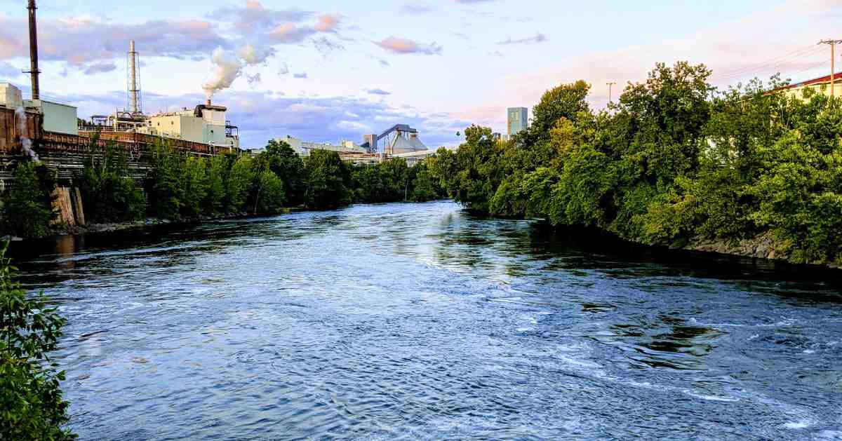
The Village of South Glens Falls is nestled on the south bank of the Hudson River across from Glens Falls, and it's a great place for a bike ride around a small community. Along the way, you can look for local birds, admire the Hudson River, visit a historic home and museum, and see the famous Cooper's Cave. This bike route features a scenic byway and side streets that will take you to each of the recommended stops.
Starting Out
Park your car at the South Glens Falls Historical Park in the northwestern corner of the village. The park offers free public parking, and it's also the entrance to the Betar Byway, the first stretch of this bike route. The South Glens Falls Historical Park has picnic areas, a gazebo, and spectacular views of the Hudson River.
Cruise Down the Scenic Betar Byway
From the Historical Park, begin your ride down the Betar Byway, a paved walking/biking path that follows the Hudson River shoreline. The Betar Byway overlooks the river for much of its length, and you'll pass through mixed woods, a small wetland area, and a beach. It's a popular birdwatching trail, so keep your eyes open for songbirds, waterfowl, and other species as you travel south.
Navigate the Streets to a Historic Home
When you reach the end of the Betar Byway, you'll arrive at Route 9. From here, ride across two crosswalks, and then head east on Charles Street. Our directions below will guide you through the residential neighborhood as you make your way to the Parks-Bentley Place, a historic house built in 1766.
The Parks-Bentley Place is now a museum and the home of the Historical Society of Moreau and South Glens Falls.
Discover the Famous Cooper's Cave
After you've spent a little time learning about local history at the Parks-Bentley Place, our route will bring you back to the northwestern corner of the village. However, before returning to the Historical Park, make a short detour down Cooper's Cave Drive to the Cooper's Cave landmark. From the overlook, you will be able to see the cave, which author James Fenimore Cooper made famous in his book The Last of the Mohicans.
The Return Trip
When you've finished snapping a photo or two, go back up the road a short distance to the Historical Park. If you'd like, you can have a picnic to celebrate the end of your trip, or take a quick car ride to Mr. Bill's Car Hop for fast food and ice cream.
South Glens Falls Route Map & Directions:
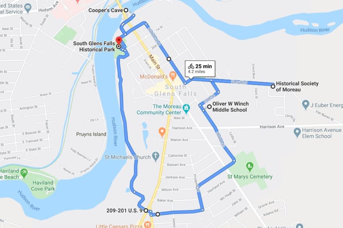
- From the South Glens Falls Historical Park, go south on the Betar Byway.
- The Betar Byway will become Beach Road and end at Route 9. Cross the two crosswalks, turn right onto Gansevoort Road, and turn left onto Charles Street.
- Ride on Charles Street, make a left turn onto Prospect Street, and then a right turn onto Wilson Avenue. Eventually, you'll round a bend onto Hudson Street.
- Follow Hudson Street to the Oliver W Winch Middle School, and then go right onto E. 6th Street. Round a bend onto Spring Street Ext., and then turn right onto Ferry Blvd. This will bring you to the Parks-Bentley Place.
- After visiting, turn left onto Ferry Blvd., and ride until you arrive at an intersection with 5th Street. Turn left, and soon after turn right onto Hudson Street. Follow Hudson Street until it becomes River Street, and then stay on River Street until you reach Cooper's Cave Drive.
- Visit the Cooper's Cave Overlook, and then go back onto Cooper's Cave Drive. Turn right onto River Street, and you'll see the South Glens Falls Historical Park nearby.
Learn About the Area on a Guided Bike Tour
Want to experience a guided tour filled with fun and interesting information of the area? Saratoga Bike Tours offers just that! Hop on your bike and embark on a 10 to 12 mile leisurely ride through Saratoga Springs. Your tour will visit some of Saratoga's most popular hotspots, like the Roosevelt Baths, historic districts, Congress Park, and more. Best of all, learn all of Saratoga's insider secrets and stories from your knowledgeable guides.
Ready to have fun and pedal away the day? Prepare for your next bike ride through Saratoga County!
This article is sponsored by Saratoga County Tourism. Note: The opinions expressed in this article are those of the authors. They do not necessarily reflect the opinions or view of Saratoga County Tourism or its members.